Great Basin road trip part two of
three: October 19-20, 2015
Ely, Nevada - Motel 6
Pounding rain and thunder add depth to the traffic noise of the
junction town. Our next destination,
Great Basin National Park (GBNP), has an
active areal flood advisory; the forecast says 100% chance of precipitation and
thunderstorms.
Groceries are spread across the table, gear on the floor and
electronics charging. It’s hard to want to pack up and drive east further into
that forecast in preparation for our next traverse. We barely escaped
finishing the Toiyabe Crest Trail before the skies opened.
We feel pretty confident, though; our forecast says we’ll be heading
into greatly-improving weather.
 |
| Traffic on the Great Basin National Park visitor center road; day before our trip |
 |
| Packing; Silver Jack Inn, Baker, NV |
---
“How much did it snow?”
“You say that like it’s stopped,” Ben says.
The walls of the duomid are sagging a bit and Ben starts to knock some
snow off to free it up. After a clear morning at lower elevations we spent the
afternoon in the clouds around 10-11,000’, summiting both Granite Peak (11,218’)
and Lincoln Peak (11,597’). We camped on a little porch of flat ground at
10,500’ overlooking a ravine on Mount Washington’s southeast slope, the park’s
largest grove of Bristlecone Pines.
The skies cleared briefly after sunset and we were treated to a sliver
of bright stars through the trees. Sometime around 3am it started snowing; light
pings of frozen moisture rather than fluffy flakes.
Reluctantly packing up after melting snow for water, while it’s still falling
outside, we decide to continue on our planned route hoping the weather will
clear as forecasted.
We summit Mount Washington (11,658’) in strong winds, blowing snow and barely pause for a selfie. The ridge we’re supposed to continue on narrows
off the summit and disappears into clouds and snow. The call to bail is made
and we head toward pretty much the only viable line of retreat: backtracking
toward camp and taking a “primitive route; navigation required” (as described
by the NPS) 3,000’ descent down North Fork Big Wash.
There is some old mining track, many sections of brush, blowdown and
avalanche debris, carved bedrock and even an old miner’s cabin replete with a coil bed frame
still in the collapsed walls.
Five hours after descending out of the clouds we’re back at the car. The
crest of the southern Snake Range, the core of GBNP, remains embroiled in gray
clouds. An area snotel station reports 10” of snow at 10,120’.
We grab the second car from our originally-intended exit point, check
the weather for our next destination, and drive northwest. We spent two and a
half days in GBNP and never even got to see Wheeler Peak. At the same time, we
spent two of those days in the mountains and never saw another person; maybe it’s
a worthy tradeoff.
 |
| Starting out from the Shoshone TH; Snake Range crest in the background |
 |
| Descending to North Fork Big Wash |
 |
| Point 11,001' |
 |
| Shoshone Trail descending to North Fork Big Wash; Ben's photo |
 |
| A random cactus around South Fork Big Wash |
 |
| Upper South Fork Big Wash and Point 11,016' |
 |
| Basin below Point 11,016' |
 |
| Starting our XC route up the east ridge of Granite Peak |
 |
| Climbing up Granite Peak's east slopes; Ben's photo |
 |
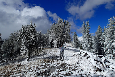
| Reaching snow line around 10,000' |
 |
| Ben's photo |
 |
| Ben walks among ancient Bristlecone Pines on Granite Peak |
 |
| Bristlecone Pine detail |
 |
| Summit of Granite Peak 11,218'; Ben's photo |
 |
| Traversing the ridge from Granite Peak to Lincoln Peak |
 |
| Traversing toward Lincoln Peak |
 |
| More Bristlecone Pines along the ridge |
 |
| Looking down South Fork Big Wash canyon and beyond to Utah |
 |
| "C'mon weather!" Ben's photo |
 |
| Approaching Lincoln Peak; Granite Peak in the background |
 |
| Bristlecone Pine |
 |
| Ermine prints |
 |
| Lincoln Peak summit ridge; Ben's photo |
 |
| And my view of Ben approaching Lincoln Peak summit |
 |
| Ben on the summit of Lincoln Peak 11,597' |
 |
| Getting same face frost on the summit of Lincoln Peak; Ben's photo |
 |
Descending Lincoln Peak, we ended up turning back off the ridge just past this point and taking a less exposed route;
Ben's photo |
 |
| The bench we traversed to get to Mount Washington's southeast slope, where we camped |
 |
| Melting snow for water in the morning |
 |
| Waking up on day two after cleaning the snow off the tent; Ben's photo |
 |
| Our shelter footprint; Ben's photo |
 |
| NPS boundary marker on Mount Washington's south slope; Ben's photo |
 |
| Mount Washington summit 11,658' |
 |
| Descending Mount Washington after the bail call was made; Ben's photo |
 |
| Descending to upper North Fork Big Wash; Ben's photo |
 |
| Ben descending |
 |
| Contouring below the east ridge of Mount Washington, which we had just stood atop |
 |
| Miner's cabin in North Fork Big Wash |
 |
| North Fork Big Wash; Ben's photo |
 |
| Some limestone pools in North Fork Big Wash |
Definitely need to go back to GBNP...


