Being a remote, difficult-to-reach peak,
Holliway Mountain is almost exclusively climbed by people going for the
Washington Top 200 list. This was Eric's 155th peak on the list and a climb I was proud to do with him given the difficulty of the route (but still being non-technical climbing).
We parked at the pullout just south of Swamp Creek, walked back up the highway and started the standard Hardy approach, contouring toward Methow Pass around 7300' (we traversed lower on the return since the snow had softened up). We were mostly able to follow the PCT corridor through snow, turning off toward Golden Creek (or Nugget Creek) at 4650' and crossing around 5100'. We went all the way up to the lakes taking the obvious gully that runs uninterrupted for 2200' vertical to a notch just below the summit. We skipped a small cliff band down low on the gully's rib, doing the same on the way down. We used crampons and poles almost all day; took axes but the steep sections were soft enough that poles were more useful.
We were only the 11th party to sign the register. The
original register from 1981 is still there as is a new Fay Pullen register from 2010. Here are
Dan Sjolseth's scanned slides from the first ascent.
 |
| 16 miles, 9400' gain |
 |
| Looking south after breaking out into the old burn; Swamp Creek parking area at bottom with Fisher, Black and Corteo |
 |
| On the approach with Hardy above |
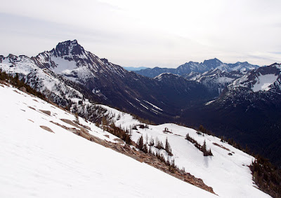 |
| Dropping down to the Methow Pass area, with Tower and the PCT |
 |
| PCT above Swamp Creek, switchbacks at Granite Pass |
 |
| Crossing Golden Creek |
 |
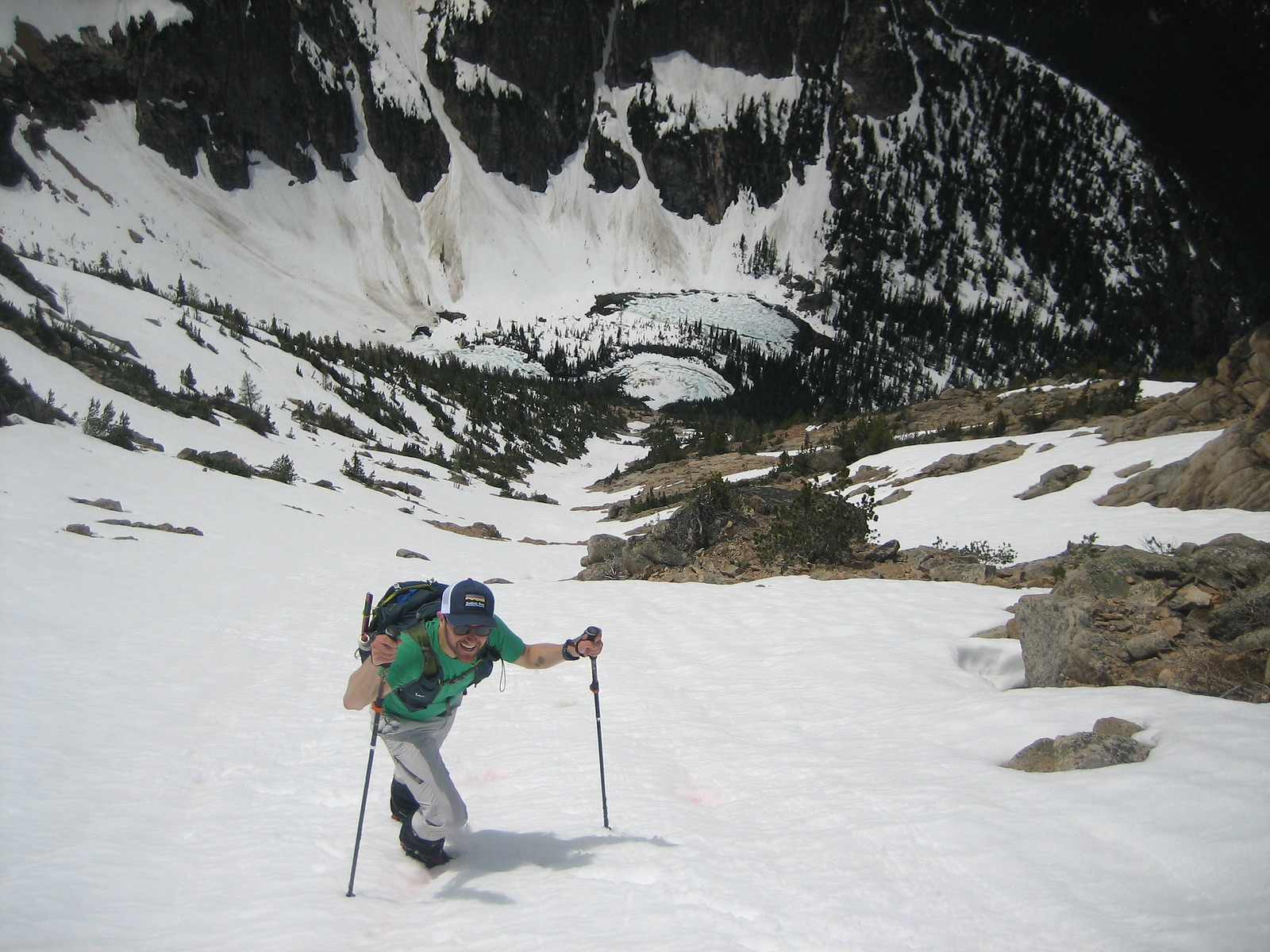
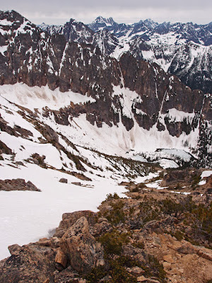
| Looking down on Nugget Lakes |
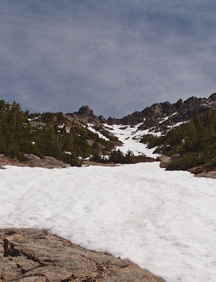 |
| 2000' of snow gully to Holliway's summit |
 |
| Climbing up the gully, Eric's photo |
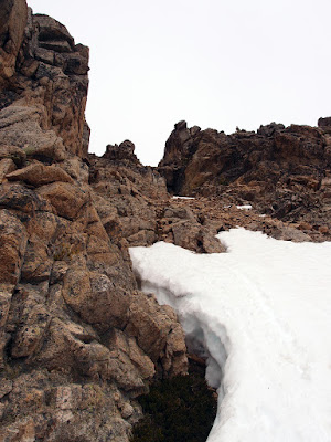 |
| About 150' vertical of class 2 rock to the notch below the summit |
 |
| Holliway Mountain summit, Azurite beyond |
 |
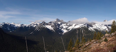
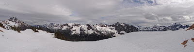
| Looking south (left) to northwest: Tower, Golden Horn, North Cascades National Park across the center, Azurite |
 |
| Looking northeast over Handcock Ridge into the Pasayten |
 |
| The new Fay Pullen register from 2010; only the fifth party (I would much rather do this with spring snow than in the fall in scree) |
 |
| Golden Horn and Black Peak, and a distant Glacier Peak |
 |
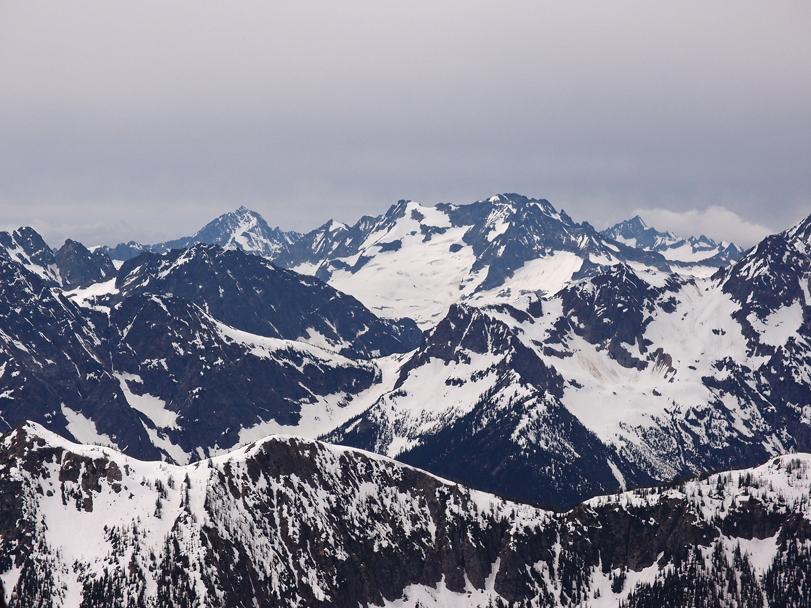
| Logan (center) flanked by Buckner (left) and Forbidden |
 |
| The Southern Pickets, Fury, Luna |
 |
| Jack, with Redoubt and Bear at left |
 |
| Putting crampons back on to descend to Nugget Lakes |
 |
| Eric climbing back up to Methow Pass, with Golden Horn |
 |
| Looking southeast to southwest from the western end of Methow Pass |
 |
| Descending the Hardy approach back to Highway 20 |